
Meriwether Lewis and William Clark led an expedition with the Corp of Discovery to see what was beyond the Eastern portion of what is now the United States of America's mainland. Find out what Lewis and Clark discovered, the dangers they faced, and how they accomplished their goals with a lesson and fun facts about their famous expedition.
Printable Lewis and Clark Lesson Plan
When the explorers set out to discover the West, they didn't have a lot of information, but were able to write about what they saw and where they went. This helped officials piece together maps of the area. Click on the image of the lesson plan to download and print a detailed lesson plan. You'll also need to print the timeline and U.S. map printables for this Lewis and Clark Blind Mapping lesson plan. Use the Adobe guide if you need help to access the printables.

Printable Lewis and Clark Expedition Timeline
To supplement the Lewis and Clark Blind Expedition Mapping lesson plan, you'll need a copy of the free Lewis and Clark Expeditions Timeline. The timeline highlights important parts of the journey across the U.S. from 1803 to 1806. You can also use the timeline for other lessons about Lewis and Clark.

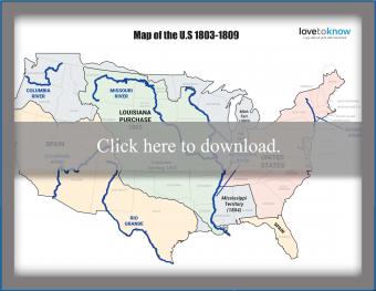
Printable Map of the U.S. From 1803 to 1809
For this lesson, you'll also need a map of the U.S. that features both modern and historically accurate areas of importance. The map reflects what the country looked like from 1803 to 1809 and shows all the modern day states. You can also use the map for other lesson plans that take place during this time period.
Lesson Plan Objective
Kids in grades four to six will make their own Lewis and Clark expedition map based on oral history alone in this fun lesson. As you present a timeline of events and locations from the expedition, students will attempt to mark these points on their map of the U.S. Kids will need to listen carefully, make inferences, and understand basic mapping skills such as direction.
Optional Lesson Plan Materials
The printable Lewis and Clark lesson plan includes a timeline of the expedition and a map of the area they explored. If you want to expand the lesson or adapt it for younger kids, you can include more materials like these:
- The Journals of the Lewis and Clark Expedition website features the actual journal entries made by members of the expedition, maps of their routes, and images of the plants and animals they encountered.
- Let kids play Lewis and Clark Into the Unknown on PBS where they have to make important choices along the journey.
- Show this 15-minute video that tells the story of the expedition and shows some historical artifacts still on display across the country.
Lewis and Clark Fun Facts for Kids
You can follow the timeline of the Lewis and Clark expedition to learn all the places the group visited and some of the simple things they did in their camps. While the journey was harsh, there were some funny, interesting, and inspiring things that came out of it.
Cool Facts About Lewis and Clark
Who were Meriwether Lewis and William Clark? Find out with these cool facts about the men tasked with leading this epic expedition.
- Lewis became secretary to President Thomas Jefferson in 1801.
- Lewis' first name was inspired by his mother's maiden name, Meriwether.
- Clark's parents had ten children.
- The War Department refused to give Lewis and Clark equal rank on the expedition, so they called each other Captain anyway to keep their real ranks secret from the others.
- Before heading out on the expedition, Lewis had to go learn from experts in Philadelphia all about plants, animals, and Native Americans he might encounter.
- Lewis and Clark had served together in the military, which is why Lewis asked Clark to lead the expedition with him.
- Lewis took a large Newfoundland dog named Seaman on the expedition with him.
- Clark kept detailed journals of the journey, but his funny way of spelling things stuck out almost as much as his discoveries.
- After the expedition, Lewis was paid a salary, given 1600 acres of land, and named Governor of the new Louisiana Territory.
- Lewis was never married and never had any children.
- Lewis died in 1809, just three years after returning from his great expedition.
- Clark named his oldest son after Meriwether Lewis.
Interesting Facts About the People Lewis and Clark Met
Lewis and Clark had a lot of help from both friends and strangers as they trekked across uncharted lands.
- Sergeant Charles Floyd was the only original expedition member to die on the journey and he died only 3 months into the journey.
- Throughout their journey the Corp met about 50 different Native American tribes.
- A French-Canadian man named Toussaint Charbonneau was living with a tribe so Lewis and Clark hired him as an interpreter.
- Even though she was pregnant at the time, the expedition leaders let Charbonneau's wife, Sacagawea, join them for the journey.
- Sacagawea had been kidnapped from her Shoshone tribe and sold to Charbonneau.
- Clark's servant, York, was the only African American man to be recruited for the expedition.
- Upon reaching the Pacific Ocean, Sacagawea and York were allowed to vote with the others on where to build their fort, a first for women and African Americans.
- Jean Baptiste Charbonneau was born on the expedition and spent his life as an infant and toddler on the journey.

Fun Facts About the Lewis and Clark Expedition
Lewis and Clark's expedition was supposed to help people understand what lie between the Mississippi River and the Pacific Ocean and locate the Northwest Passage. Today you can visit the actual Lewis and Clark Trail in Washington state and hike their real trail from the Missouri River to the Pacific Ocean. If you're not able to get out and hike the trail, you can use an interactive Google map to see their route and learn facts about different places.
- The total journey of the expedition covered around 8,000 miles.
- Along with medical supplies, camping supplies, and weapons, the group took books on botany, astronomy, and geography on the trip.
- All the initial expedition members Lewis trained were unmarried men with great survival skills.
- During one hunting trip, Lewis was accidentally shot in the bum, but he survived.
- The group brought home samples from about 120 different animal species.
- In addition to maps and animal species, the group also brought home about 200 plant samples.
Discover Great Explorers
While Lewis and Clark are names every kid learns, they couldn't have had a successful expedition without the help of a lot of friends and strangers. Learning about explorers for kids helps you see how people discovered new places, plants, animals, and cultures through bravery and teamwork. You can learn more about Lewis and Clark with history board games, like The Lewis and Clark Adventure Game, or by reading historical fiction for children.


